Finalrentals Blog


Published in Trips Category.
Lake Lucerne is one of Central Switzerland’s most scenic driving areas. Its bays and connected basins are beneath Mount Rigi, Mount Pilatus, and the Uri Alps. The unusual shape gives you very different views within a fairly small region.
When driving around Lake Lucerne, you can stop at villages, promenades, and viewpoints whenever you like. This road trip around Lake Lucerne takes you through Küssnacht, Weggis, Vitznau, Gersau, Brunnen, Beckenried, and Stansstad.
You can rent a car at Zurich Airport and drive towards Lucerne. Our guide covers the route, main stops, ferry options, parking, and useful driving tips.
Lake Lucerne One-Day Driving Route
This one-day route starts and ends in Lucerne, following a clockwise drive through Küssnacht, Weggis, Vitznau, Gersau, and Brunnen. You can return to Gersau for the seasonal ferry to Beckenried, then continue through Stansstad.
Start and Finish in Lucerne
Start in Lucerne and head clockwise towards Küssnacht am Rigi. From there, continue through Weggis, Vitznau, Gersau, and Brunnen. After Brunnen, drive back to Gersau and take the ferry across to Beckenried. You can then continue through Stansstad before returning to Lucerne.
Lucerne to Küssnacht is about 11.6 kilometres and takes around 15 minutes. Stansstad is about 12 kilometres from Lucerne by the direct route. With the ferry crossing included, you will drive roughly 70 to 80 kilometres. Plan around 7 to 9 hours for stops, meals, parking, and the ferry.
Drive Clockwise Around Lake Lucerne
You can travel in either direction, but the clockwise route places the ferry later in your day. When driving around Lake Lucerne, remember that the lake does not form one simple circle. Its separate arms and basins curve between mountain slopes and peninsulas. There is no single road that follows the entire shoreline. Your route will pass through different roads between the main lake areas.
Use the Gersau to Beckenried Ferry
The Gersau to Beckenried ferry carries cars across Lake Lucerne in about 20 minutes. It saves roughly 50 kilometres compared with the longer road route. The ferry is seasonal, so check its timetable before your trip. Reservations are generally unavailable, so arrive before your preferred departure. Without the ferry, continue from Brunnen towards Flüelen using the A4 Axenstrasse, a road that passes through tunnels and galleries beside Lake Uri.

Best Stops Around Lake Lucerne by Car
These stops make driving around Lake Lucerne easy to follow, with each place leading naturally to the next. The route includes lakeside villages, waterfront walks, mountain views, and practical places to stop for food. You only need to retrace a short section before taking the ferry towards Beckenried.
Küssnacht am Rigi
Küssnacht is your first lakeside stop on the route. From Zurich Airport, the drive covers about 53 kilometres and takes around 40 minutes in light traffic. You can travel towards Zug, then continue on the A4 to Küssnacht without taking a ferry. The town sits below Mount Rigi beside the northern part of Lake Lucerne.
Walk along the promenade and public quay for open views across the water. Its compact centre makes Küssnacht easy to explore in around 20 to 30 minutes before you continue towards Weggis.
Weggis
Follow the shore towards Weggis, a lakeside village set directly below Mount Rigi. Its main appeal is the wide lake panorama, with views stretching towards the surrounding Alpine peaks.
Take around 30 minutes to walk along the waterfront promenade and Oberdorf Quai. You can also wander through the village centre before returning to the car. Weggis is worth stopping for because you get open lake views without adding a long detour. Village car parks are available, along with spaces near the mountain cable-car station. Parking can become busier on sunny weekends.
Vitznau
The drive from Weggis to Vitznau is about 6.5 kilometres and usually takes around 10 minutes. Much of the road stays close to the lake. Vitznau is worth stopping for its harbour views and close setting beneath Mount Rigi. Walk around the waterfront and watch boats crossing the lake. The village also has a relaxed centre near the mountain railway station.
The railway climbs from Vitznau to Rigi Kulm in around 30 minutes each way. This makes Vitznau a good base if you want to add a mountain trip. For this one-day route, keep the visit short if you want to see all the lakeside stops. A full Mount Rigi trip can take several hours, including the return journey and walking time.
Gersau
Continue south to Gersau, a small historic community beside the lake. You can walk between the waterfront, the old town hall, and the Baroque church. Gersau is also a practical lunch stop before continuing to Brunnen. You will later return here for the ferry. Some parking spaces use meters, while others require a parking disc. Check the local parking signs before leaving your car.
Book a car with Final Rentals to follow the full Lake Lucerne route on your own schedule. Your rental includes unlimited mileage, plus Collision Damage Waiver, Theft Waiver, and Third-Party Liability, included in the rental amount. These inclusions are useful for a full day of village stops, ferry crossings, and scenic detours.
Brunnen
Brunnen is about 6 to 8 kilometres from Gersau and usually takes around 10 minutes by car. It marks the northern entrance to Lake Uri, where the scenery becomes more dramatic.
Walk along the promenade and harbour for clear views towards the Uri Alps. The lake narrows here, while steep mountain slopes rise close to the water. This makes Brunnen a good stop for a different view from the wider lake scenery around Weggis and Vitznau. You can also explore the centre before continuing your drive.
Stansstad
Stansstad is your final main stop before returning to Lucerne. It sits near Stansstad Bay and the Lake Alpnach basin. Take a short walk by the waterfront and enjoy views towards the wider Pilatus area. The setting differs from the villages below Mount Rigi. The direct drive back to Lucerne is around 11 kilometres, which can take about 15 minutes in light traffic.

Driving Tips Around Lake Lucerne
Good planning keeps driving around Lake Lucerne relaxed. You will use motorways, local roads, village streets, and lakeside sections during the trip.
Roads Around Lake Lucerne
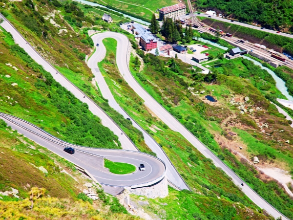
The route includes motorways and local roads, with several curving sections beside the lake. Weggis, Vitznau, and Gersau have narrower village roads.
Drive slowly through built-up areas and watch for cyclists, buses, and parked cars. Use signed parking areas whenever you stop for photos. The Axenstrasse alternative also includes several tunnels and galleries. Traffic and parking can make short route estimates longer.
Swiss Motorway Vignette
You need a Swiss motorway vignette on designated motorways and expressways. Switzerland offers both a windscreen sticker and an electronic version.
Some local Lake Lucerne roads do not require one. However, faster connections may take you onto roads where the vignette is compulsory. Before leaving the rental location, check whether your car already has a valid vignette. Rental arrangements can differ between cars.
Parking Around Lake Lucerne
Use official public parking at each stop. Weggis and Vitznau have parking close to their mountain transport stations. Gersau uses meters and parking-disc zones. Brunnen and Beckenried also have a combination of municipal and timed parking spaces. Always read the parking signs where you stop. Time limits, payment methods, and rules can vary between locations.
Seasonal Road and Ferry Conditions
Summer usually brings more visitors and traffic, especially during sunny weekends. Starting earlier gives you more flexibility for parking and sightseeing. Rain and fog can reduce visibility in the mountains and make lakeside bends harder to see. Slow down and keep more braking distance.
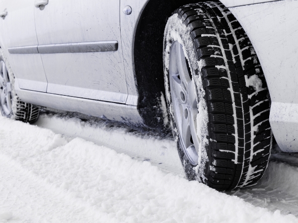
Switzerland does not require winter tyres in every situation. However, you must keep full control of your car in winter conditions. Before driving around Lake Lucerne, check ferry and road conditions. The Gersau-Beckenried ferry is seasonal, and the Axenstrasse can sometimes be closed.
Takeaway
Driving around Lake Lucerne is an exciting one-day trip because the scenery changes often between each stop. Weggis and Vitznau give you open lake views, while Brunnen feels more dramatic near Lake Uri. The short distances also make it easier to explore several villages with less driving.
Rent a car in Zurich with Final Rentals to explore the Lake Lucerne route on your schedule. Unlimited mileage gives you flexibility for scenic detours, while approved EU cross-border travel can support a longer Swiss or European holiday. Book and manage your car rental at any time. Download the Final Rentals app on Google Play and the App Store.
Frequently Asked Questions
Can you drive around Lake Lucerne in one day?
Yes. You can travel from Lucerne through Küssnacht, Weggis, Vitznau, Gersau, and Brunnen. Then take the ferry to Beckenried, continue through Stansstad, and return to Lucerne. Plan roughly 7 to 9 hours for the full day. This gives you time for parking, short walks, lunch, and the ferry without counting only the driving time.
Does driving around Lake Lucerne require the Gersau to Beckenried ferry?
No. The Gersau to Beckenried ferry is a seasonal shortcut rather than a required part of the route. The crossing takes about 20 minutes and saves roughly 50 kilometres of road travel. If the ferry is not operating, continue through Brunnen towards Flüelen on the Axenstrasse. From there, follow the main roads north towards Beckenried.
Is a Swiss motorway vignette required when driving around Lake Lucerne?
You need a Swiss motorway vignette when you use designated motorways or expressways. Some local Lake Lucerne roads do not require one, but faster connections may. With a rental car, check whether a valid vignette is already affixed or electronically registered. Check this before entering the motorway, so you do not buy another vignette unnecessarily.